Core Competencies
Conaway Geomatics
The Geomatic Company that happens to be a Disabled Veteran owned and operated business.
Welcome to Conaway Geomatics
As a Disabled Veteran-owned and operated business, Conaway Geomatics is committed to delivering exceptional service and value to our clients. Our mission is to bring a balanced approach to all the projects we work on, ensuring that every client’s needs are met with precision and efficiency.
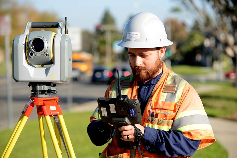
Geomatic Services
Conaway Geomatics offers a comprehensive assortment of land surveying and geographical information systems (GIS) services focused on meeting clients project goals and objectives. Our team of experts are experienced in traditional and adaptive geomatic solutions brining a depth of knowledge to any project or project team. These services include but are not limited to;
- Boundary Surveys
- ALTA Surveys
- Right-of-Way Surveys
- Mobile Mapping
- UAV Mapping
- GIS Web Applications
- Geodatabase Design
- As Built Surveys
- Basemapping
- Cartographic Mapping
- Substructure Utility Mapping
- Construction Staking
- Control Surveys
- Volume Calculations
- Digital Terrain Modeling
- Topographic Mapping
- Lot Line Adjustments
- Lot Merger
- Record of Survey
- Plat and Legal Descriptions
Subsurface Utility Engineering Services
At Conaway Geomatics, our Subsurface Utility Engineering (SUE) Department is dedicated to providing precise and reliable utility detection and mapping services. We utilize state-of-the-art technology and advanced techniques to accurately identify and verify underground utilities, enhancing project safety and reducing potential conflicts in your infrastructure projects. Our services encompass, but are not limited to;
- Utility Research
- Utility Detection
- Utility Mapping
- Electromagnetic Locating
- Ground Penetrating Radar (GPR)
- SONDE Locating
- Concrete Scanning
- 811 Dig Alert Coordination
- CCTV Pipe & Cable Inspection
- Void detection
- Color Coded Site Markings
Professional Consulting
We understand that not all projects are created equally, that is why our company provides geomatic consulting services. Our geomatic experts assist clients to identify program/project requirements, develop workflows and procedures than assist with implementation and training (if applicable); delivering an adaptive solution focused on providing top notch results. We can’t wait to see how these services could improve your projects quality, safety, schedule or cost;
- Program Management
- Geomatic System Analysis
- Procedure Documentation
- Geomatic project approach
- Process Development
- Workflow Mapping
- GIS Consulting
- Easement and Deed Analysis
- CADD Consulting
- Staff Augmentation
- GIS Asset Inventory